

First new Central Link Project road opening end September
Infrastructure Malta is opening the first new road of Central Link Project, a two-lane westbound carriageway from Balzan to the Wied Incita area of Attard, by the end of September.
Central Link Project is a €55 million investment to reduce travel times, improve air quality and create safer spaces for alternative modes of travel along the principal arterial road corridor in Central Malta, between Mriehel and Ta’ Qali.
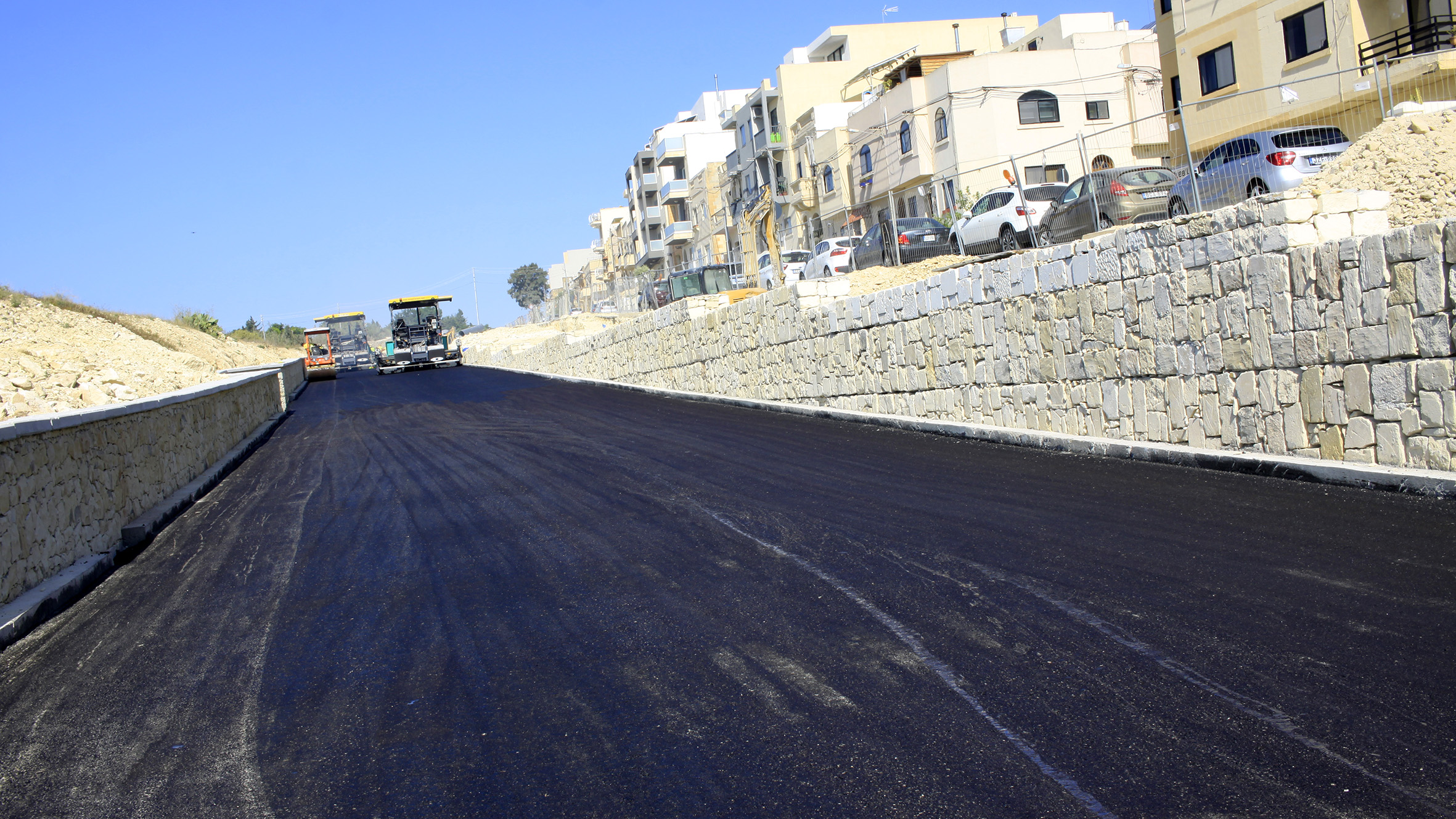
This week, contractors started laying asphalt on parts of the project’s first new road, after forming its structure and laying its underground networks earlier this year. At the same time, the agency is launching works on another phase of this project, including the widening of the western end of L-Imdina Road, from Wied Incita to Ta’ Qali, for two new lanes and a new segregated cycling and walking track. Infrastructure Malta is extending this track all the way to Mriehel, to develop the longest cycling route of its kind ever built in Malta.
The two new westbound (Mriehel to Ta’ Qali) lanes opening in September start at the T-Junction between L-Imdina Road and De Paule Avenue (San Anton Gardens area) and bypass the centre of Attard before merging with L-Imdina Road again in the Wied Incita area (near Mount Carmel Hospital). When the project is ready, the new lanes will eliminate several bottlenecks and inefficient traffic lights junctions impacting the centre of Attard, Balzan, Lija and Birkirkara, whilst opening space for wider footpaths, safer pedestrian crossings, improved bus lay-bys, new segregated cycling tracks and more landscaped areas.
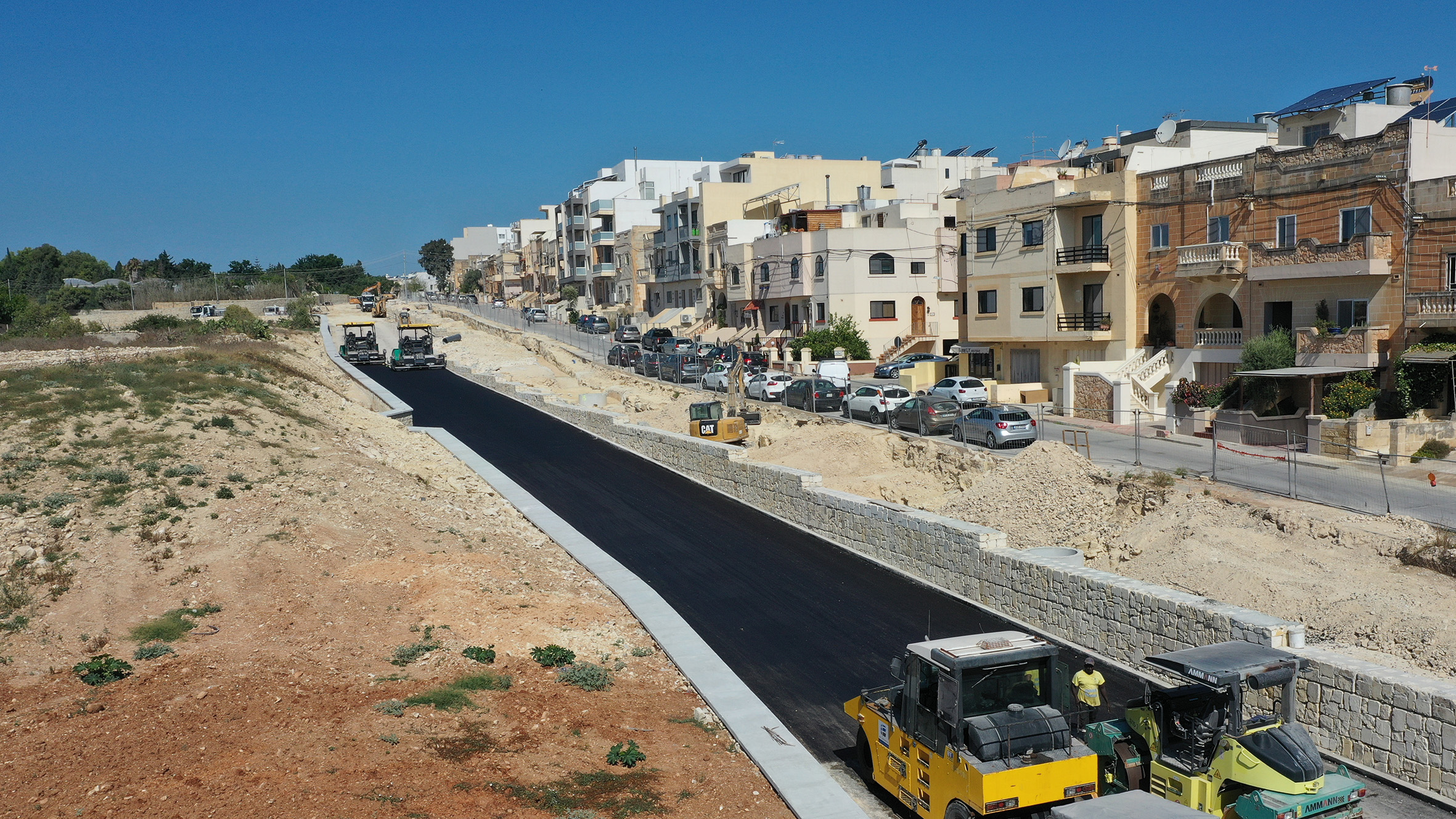
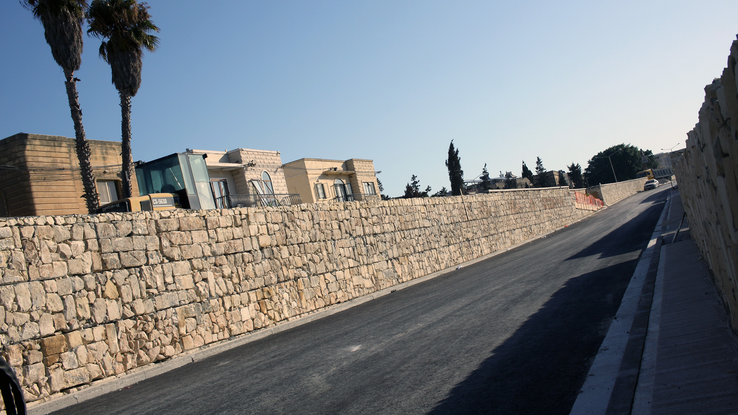
To form this part of the road, workers excavated 50,000 tonnes of rock and other materials. They built 2.8 kilometres of retaining and boundary walls and used 32 tonnes of subbase material to lay the carriageway’s foundations. Beneath the new road surface, Infrastructure Malta installed 10 kilometres of new underground networks, including water pipelines, sewers, electricity cables and street lighting and Internet cable ducts. They also built a stormwater catchment system that will be connected to the region’s flood relief underground tunnels nearby.
The agency’s architects designed the new westbound carriageway to have the least possible impact on nearby residential areas. This new road is separated from three nearby residential roads, Ferdinandu Inglott Street, Oliver Agius Street and Tumas Chetcuti Street, with a landscaped area and another section of the new three-metre segregated bi-directional cycling and walking track. Moreover, Infrastructure Malta built most of the new road at a lower level, up to three metres (one storey) beneath the three residential roads, to reduce its visual impact as well. It is also rebuilding these streets with new footpaths, underground networks and other facilities, as part of the same project.
The development of the long-awaited Central Link Project started last January with the formation of the first sections of the new carriageway that will be opened in September. This project is based on plans included in the 2006 Central Malta Local Plan, which had already indicated congestion along L-Imdina Road, In-Nutar Zarb Road and other nearby roads as a major problem for Attard and nearby localities. Infrastructure Malta optimised these 2006 plans to augment long-term efficiency and sustainability, to mitigate adverse impacts on adjacent lands and to add safer infrastructure for bus passengers, pedestrians and cyclists, which are currently almost inexistent along this route.
The National Transport Master Plan 2025 also highlights the importance of this investment, listing the L-Imdina Road and In-Nutar Zarb Road corridor as the 12th of 29 priority sections of the EU’s TEN-T network in Malta that need to be urgently upgraded for increased safety and efficiency.
The project will halve travel times in this area and drastically reduce congestion pollution in nearby residential areas by reconstructing 13 junctions, removing four traffic lights systems and adding over seven kilometres of new lanes along a 4.3 kilometre road corridor. It also introduces many facilities for alternative modes of travel, including 10 kilometres of safe pedestrian footpaths and segregated crossings, bus lay-bys and the longest segregated cycle track in the Maltese Islands, connecting Mriehel, Birkirkara, Balzan, Attard and Ta’ Qali. Infrastructure Malta will also develop over 24,000 square metres of new landscaped areas along the project route.
Air quality studies conducted by independent experts during the planning stage of the project show that by eliminating existing bottlenecks and congested junctions, this investment will lead to major air quality improvements in several nearby residential areas in Mriehel, Birkirkara, Balzan and Attard. In fact, the project will reduce particulate matter by up to 66% by 2030, even when considering future transport demand. Similarly, nitrogen dioxide emissions will also decrease by 41%. Particulate matter and nitrogen dioxide are the two main pollutants linked to road transport emissions, and a major cause of respiratory illnesses.